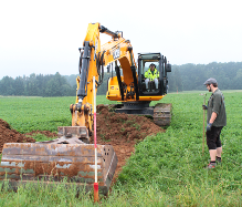
+49 7071 1473780
+49 176 22642119

Magnetic prospection. 
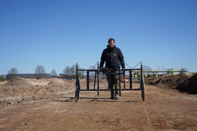
If larger areas need to be examined before the actual construction project commences, various methods of preliminary investigation and survey are used. For example, potential archaeological sites can be identified
 – rather classically – by evaluating historical maps and writings, archive records, and aerial and satellite images. However, science-based methods such as magnetic prospection are becoming increasingly effective and reliable methods. They can often achieve a precise assessment of the subterranean features located in the desired area.

We carry out the required procedures on your behalf.

As a rule, the first step in the preliminary investigation is to sift through and gather all known archaeological sources about a potential construction site or a scientific area of interest. For this purpose, we systematically assess literature, historical maps, field maps, databases, aerial photographs, and LiDAR data. The information is processed by our team and recorded in a spatially-mapped and analysed Geographic Information System (GIS).
For the aerial photographic documentation of archaeological structures or historical buildings, we have various drones at our disposal which enable us to create high-resolution photographic and film material regardless of size and complexity.

On the basis of these high-resolution photos, we can create high-resolution digital terrain models or three-dimensional representations of monuments using the Structure-from-Motion (SfM) process. The 3D models calculated by us are characterised by a very precise object geometry and high colour quality.
An important element in the identification of suspected archaeological sites is the field survey. In this process, the surface of the potential archaeological site is walked by several people in a tight grid which allows finds to be located, precisely measured, and recovered. By assessing the scattering of finds, conclusions can be drawn about soil features and the spatial extent of the site.

The challenge of recognizing often inconspicuous finds and structures is considerable and requires the utmost expertise and experience – our team has been specially trained for this purpose, and data acquisition using mobile devices allows for the inspection to be carried out in a time-saving and precise manner.
Magnetic measurements are an integral step of modern survey strategies. This measuring method, conceived originally for the geosciences, can be used to display subterranean archaeological objects and structures. Using the portable 4-probe Fluxgate Differential Magnetometer from Foerster (Ferex 4.034), our qualified personnel carry out magnetic measurements in the field and analyse the obtained results quickly and efficiently.
Core samples obtained through boring provide direct information of the stratigraphy of a respective archaeological site. The material contained in the drill cores can also be used for archaeobotanical investigations and 14C dating.
Our drill bits have diameters of 5 cm, 6 cm, and 8 cm with the ability to reach depths of 5 m, depending on the soil.


© Copyright 2021 ArchaeoConnect GmbH